


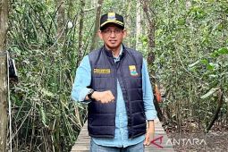
Jambi (ANTARA) – Jambi’s forest-fire task force reported that 5,167.84 hectares of land had burned through October 27, 2026, and said it uses the Forestry Ministry’s SiPongi system and reports from relevant agencies to update fire data daily.
Task force spokesman Johansyah said its digital monitoring system draws on SiPongi, data from Indonesia’s Meteorology, Climatology, and Geophysics Agency (BMKG), and official reports from districts and cities.
“We use SiPongi, BMKG data and reports from districts and cities,” he said here Wednesday.
The daily reporting cutoff is usually 7 p.m. local time, after which the data are processed, updated and periodically released to the public.
Updates are generally published at night or, at the latest, the following morning.
Reporting delays usually stem from technical issues, including the time needed to download data and compile reports, which may not be completed until nighttime, he said.
In 2026, Jambi reported 5,167.84 hectares burned by October 27: Batang Hari, 1,470.70; Sarolangun, 958.25; Tanjung Jabung Timur, 872.12; Tanjung Jabung Barat, 674.75; Muaro Jambi, 635.02; Tebo, 403.76; Bungo, 86.75; Merangin, 56.50; Jambi city, 10.
Seven fire sites totaling 61.55 hectares were reported Wednesday in East Tanjung Jabung district: Sungai Benuh (2), Sungai Jeruk (1), Sungai Rambut (50), Berbak National Park (3.5), Pematang Mayan (1), Rano (0.05) and Simpang (4).
“Daily reports are updated at night or generally released the next morning. The calculation method remains based on official data submitted through the system,” he said.
Related news: BNPB confirms wildfire spots in Jambi continue to decrease
Related news: Indonesia intensifies forest firefighting in four provinces
Related news: BNPB runs week-long weather modification in Jambi to prevent wildfires
Translator: Agus S, Rahmad Nasution
Editor: Azis Kurmala
Copyright © ANTARA 2026